Tripura's Highest Point
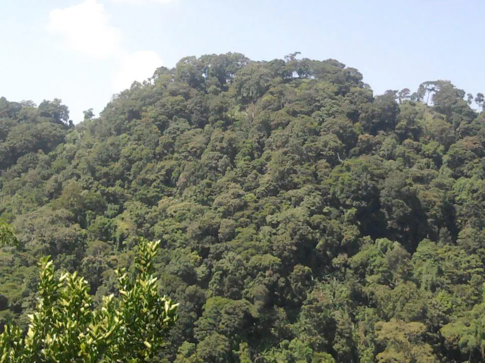
Betlingchhip (also spelled Betling Sib) is Tripura's highest point, at roughly 939 metres (about 3,084 ft), rising out of a dense-forested hill range in South Tripura district. It's a genuine off-the-beaten-path trek destination — far less developed than Northeast India's better-known trekking spots, and appealing mainly to trekkers and nature enthusiasts specifically looking for something offbeat rather than a polished tourist trail.
The surrounding forest is thick and biodiverse, home to varied flora and fauna, and the wider area has been discussed for greater conservation protection given its ecological value. What it doesn't have is any of the trekking infrastructure travellers might expect elsewhere — no resorts, cafes, or marked trail signage near the summit, which is exactly the appeal for trekkers seeking a genuinely quiet climb.
Most treks start from a nearby forest-fringe village in South Tripura and involve forest trails with some steep sections closer to the top. Given the remoteness, a local guide and forest-department awareness of current access conditions are both worth arranging before you go.
⛰️ Betlingchhip at a Glance
Best Time to Trek Betlingchhip
Trail conditions swing dramatically between seasons — this is a forest trek, and the monsoon changes it completely.
Cool, dry conditions keep the forest trail firm and manageable — the safest and most comfortable window for the climb.
Heat and humidity climb ahead of the monsoon — an early start becomes more important to avoid the hottest hours on exposed stretches.
Slippery forest trails, leeches, and landslide risk make this the window to skip entirely for this particular trek.
The most reliably dry stretch of the year, with the clearest conditions for the final push near the summit.
Our pick: October to February — dry trails and cool temperatures make this the only genuinely comfortable window for the climb.
How to Reach Betlingchhip
Getting to the trailhead is a two-stage journey: a drive into South Tripura, followed by the trek itself.
- By road from Agartala: A substantial drive, well over 100 km, into South Tripura district — plan for a half-day of driving before the trek even begins.
- Basing yourself in a South Tripura town: An overnight stay in the nearest town lets you start the trek early rather than combining a long drive with the climb on the same day.
- Arranging a guide in advance: Given limited signage and mobile connectivity near the trailhead, it's worth confirming a local guide before you set out from Agartala.
The Trek & Terrain
The Approach
The trek begins from a nearby forest-fringe village, following forest trails through dense tree cover — the kind of quiet, largely untouched terrain that's increasingly rare to find this accessible in Northeast India.
Difficulty & Duration
Moderate overall — mostly forest trail walking with some genuinely steep stretches closer to the summit. Expect a few hours each way for a reasonably fit trekker, with the ascent naturally slower than the descent.
Flora & Fauna
The forest cover supports a good diversity of plant and animal life, part of why the wider area has been discussed for greater conservation status — keep an eye (and ear) out, but don't expect guaranteed wildlife sightings on a day trek.
The Summit
Tripura's highest point rewards the climb with views over the surrounding forested hills — a quiet, uncrowded payoff very different from more commercial Northeast India trekking destinations.
Where to Stay Near Betlingchhip
There's no accommodation at the peak itself — trekking here is typically a day trek from the nearest South Tripura town, with very limited options beyond basic guesthouses.
- → Basic guesthouses, nearest South Tripura town
- → Simple lodges near the trail base
- → Homestays where available
- → Better hotels in a larger South Tripura town
- → Government tourist lodges nearby
- → No dedicated luxury stays near the peak
- → Consider Agartala for upscale accommodation
Suggested Visit Plan
Agartala to South Tripura Base
- ✓Drive from Agartala to the nearest South Tripura town
- ✓Confirm guide and current trail access
- ✓Rest early for a pre-dawn start
The Trek
- ✓Early departure for the trailhead
- ✓Forest trek to the summit and back
- ✓Drive back toward Agartala by evening
* With a very early start, an experienced group could combine the drive and trek in a single long day — an overnight base is still the more comfortable option.
Food & Supplies
- Carry your own food and water: There are no facilities on the trail itself — pack enough for the full trek plus a margin.
- Stock up in the base town: Basic supplies and simple meals are available at the nearest South Tripura town before you set out.
- No dining options near the trailhead: Treat this as a genuinely self-sufficient day out.
Budget Breakdown
| Expense | Budget | Mid-Range | Luxury |
|---|---|---|---|
| Accommodation/night | ₹600 | ₹1,800 | N/A |
| Car hire from Agartala (round trip) | ₹6,500 | ₹9,000 | ₹12,000 |
| Local guide (per trek) | ₹800 | ₹1,200 | ₹1,500 |
| Food/day | ₹350 | ₹700 | ₹1,200 |
* Figures are per person, per day (except car hire, a round trip figure best split across a group).
Essential Tips for Trekking Betlingchhip
- Hire a local guide: Given the remoteness and limited signage, this is the single most important thing you can arrange in advance.
- Carry sufficient water and a first-aid kit: There's nothing to buy along the trail itself.
- Inform your accommodation of your plan: Let someone know your trek route and expected return time given the remoteness.
- Start early to summit and descend in daylight: Forest trails are far harder to navigate safely after dark.
- Check current access with the local forest office: Conditions and permissions in remote forest areas can change seasonally.
✅ Do
- →Hire a local guide before setting out
- →Start the trek at first light
- →Carry your own food, water, and first-aid supplies
- →Check current forest-access conditions ahead
- →Wear proper trekking footwear
- →Tell someone your planned route and return time
❌ Don't
- →Trek without a local guide
- →Attempt this in the monsoon months
- →Expect any facilities on the trail itself
- →Start the climb late in the day
- →Rely on mobile signal near the trailhead
- →Expect resort-style accommodation nearby
Frequently Asked Questions
How high is Betlingchhip?
Roughly 939 metres (around 3,084 ft) above sea level, making it Tripura's highest point — modest by Himalayan standards, but a genuine summit trek within the state.
Is the Betlingchhip trek difficult?
Moderate. The route is mostly forest trail with some steep stretches nearer the summit, manageable for a reasonably fit trekker in a few hours each way, but there's no tourist infrastructure, so self-sufficiency matters.
What is the best time to trek Betlingchhip?
October to February — cool, dry conditions with clear trails. Avoid the monsoon (roughly June–September), when the forest floor turns slippery, leeches appear, and landslide risk rises.
Do I need a guide for Betlingchhip?
Strongly recommended. The area is remote with limited signage, and a local guide familiar with the trail and current forest-access conditions makes the trek significantly safer and easier to navigate.
How far is Betlingchhip from Agartala?
Substantial — well over 100 km into South Tripura. Most visitors drive to a base town in South Tripura first, either starting the trek early the same day or staying overnight nearby before setting out.
Is there accommodation at the peak?
No — Betlingchhip has no tourist infrastructure at the summit. Trekkers do it as a day trek from a nearby base town, with camping only for well-prepared, guided groups rather than casual visitors.
Published by the Kudozz Club editorial team · Last updated · How we research our guides
Want us to plan this trip for you?
Tell Kudozz Club where you want to go and what kind of trip you’re looking for. We’ll build a Betlingchhip and Tripura itinerary around your dates and budget.
Continue Exploring
View all guides Trekking
Valley of Flowers Trek Guide: Permits, Routes, Best Time & Tips
A meadow of 300+ Himalayan wildflowers that blooms for just 8 weeks a year — the complete guide to India's most extraordinary trek.
 Trekking
Kasol & Kheerganga: The Backpacker's Himalayan Trail
Follow the Parvati River to natural hot springs through pine forests and tiny Himalayan villages.
 Trekking
Mount Saramati Trek: Nagaland's Highest Peak
A remote, expedition-level climb to 3,826 metres near the India-Myanmar border — rarely attempted, and genuinely demanding, the complete Mount Saramati guide.
 Trekking
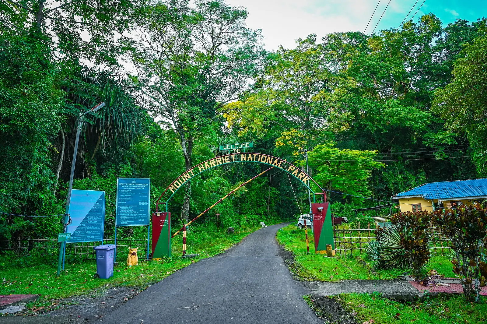
Mount Manipur (Mount Harriet) Travel Guide: Trek & Views
South Andaman's highest point, across the harbour from Port Blair — colonial-era ruins, forest trails, and panoramic views over Ross Island and North Bay.